As an
implicit geological modelling pioneer and advocate, I often get asked the following question regarding geological modelling:
Question:
Resource geologists generally favour the use of sectionally hand-digitised wireframe models for resource estimation (e.g. created with Vulcan, Datamine, Gemcom or numerous other mining software packages available on the market). This is considered industry best practice as some orebodies are constrained within a certain shape or lithology and the wireframe model is considered to be most appropriate modelling method for the estimation of resource of such deposits. Automated methods that rely on 3D interpolation, such as Leapfrog software, are generally not considered appropriate, but can Leapfrog’s faster modelling method similarly be accepted in the industry as producing JORC or SAMREC compliant orebody models?
Answer:
The short answer is "Yes", but the long answer is as follows.
A part of SAMREC (p.46) that relates to resource estimation states:
MINERAL RESOURCES (B)
(i) Describe the determination of and estimation techniques applied to volume, density, grade, size distribution, value, geotechnical, geo-hydrological, geometallurgical or other appropriate models (e.g. section, polygon, inverse distance, geo-statistical or other method) should be stated and justified,
together with key assumptions and implications thereof, including any adjustments made to data (i.e. compositing, grade cutting / capping), sample spacing, estimation unit size (block size), selective mining units, reconciliation, domaining and maximum distance of extrapolation from data points.
(ii) Describe assumptions and justification of correlations made between variables.
(iii) Discuss the block or grid cell size in relation to the average sample spacing and any assumptions behind modelling of selective mining units (and nonlinear estimation techniques if used).
(iv) Any relevant specialized computer program (software) used should be named (with the version number) together with a reference to where all the original files are stored for this specific model.
(v) State the processes of checking and validation, the comparison of model information to sample data and use of reconciliation data, and whether the Mineral Resource estimate takes account of such information.
(vi) Describe the assumptions made regarding the estimation of any by-products or deleterious elements.
As long as the geological assumptions are clearly stated and that these assumptions are reasonably consistent with the data, JORC or SAMREC does not specify what methods specifically should be used resource estimation process. It is therefore inappropriate to suggest that a certain methods of modelling (e.g. sectional digitisation) are more appropriate over other methods of modelling.
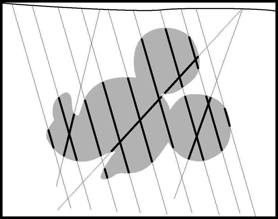
Having said this, it is desirable to implement the most up-to-date and accurate method of shape modelling for bodies that constrain ore for the purposes of resource estimation. The most appropriate method of shape modelling can be assessed according to the accuracy in which the method can mimic a known object. To demonstrate this, I have chosen a silhouette of a well-known object and sub-sampled this object with some drillholes (
Figure 1).
 Figure 1: Silhouette of Mickey Mouse
The objective of this exercise is to model Mickey from just the drillhole intercepts using two methods: the traditional sectional digitisation method, and the minimum curvature method of interpolation used in Leapfrog software. The sample of the drillholes used is shown in
Figure 2.
 Figure 2: drillhole samples of Mickey Mouse
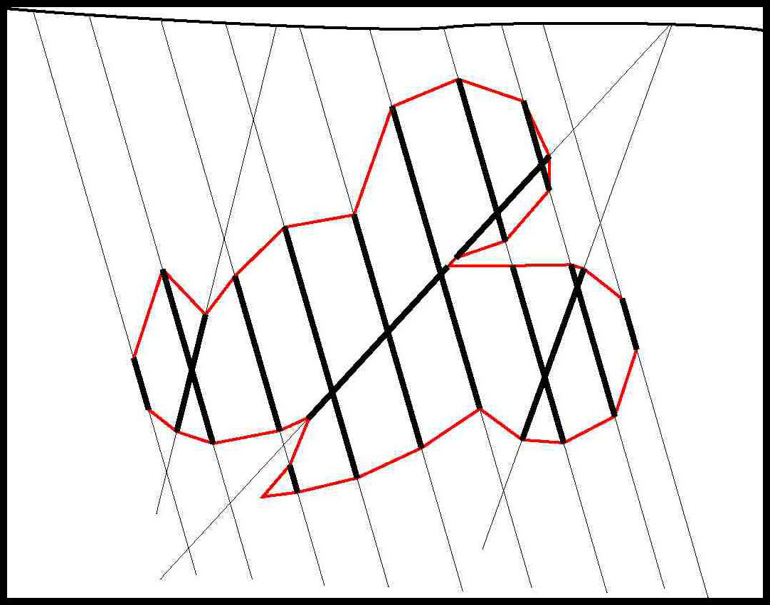
The result of hand digitising the shape is shown in
Figure 3. This method ensures that the ends of the “Mickey lithology” are honoured, therefore the modelled Mickey shape is perfectly honoured to these sample end-points. In between the samples, however, these points are joined as straight lines. To keep the modelling simple so that it can be replicated by other interpreters, extra points were not digitised apart from the lower lip protrusion of Mickey.
 Figure 3: Model produced from traditional digitisation
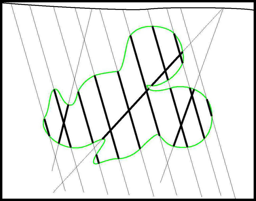
A minimum curvature method of interpolation, which is the method of interpolation used in Leapfrog software, results in the model shown in
Figure 4.
 Figure 4: Minimum curvature model of Mickey. Note that this is a simulation of a model that would be expected to be produced by Leapfrog.
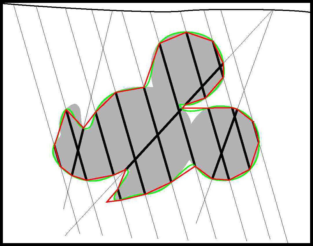
As with the traditional method of sectional digitisation, the contacts boundaries of the “Mickey lithology” is perfectly honoured with this method of modelling. Not only the contacts of the Mickey outline perfectly honoured but this method works out the best-fit curvature line that fits all of the points, so that the line smoothly curves its way through all points. The comparison between the two methods is shown in
Figure 5.
 Figure 5: Comparison of traditional digitisation and minimum curvature method of interpolation. Minimum curvature method yields the closest fit with the Mickey’s silhouette
A summary of Leapfrog’s method of 3D modelling over traditional method of hand digitisation are summarised below in
Table 1.
 TABLE 1: A comparison of Leapfrog modelling and traditional digitisation
This simple comparison of the two methods illustrates that there is no basis of the claim that traditional digitisation is superior over Leapfrog generated models. In fact
Table 1 summarises reasons why Leapfrog’s modelling method is far superior over hand digitisation.
In modelling of true 3D objects, such as ore bodies, Leapfrog’s method of interpolation does not rely on sectional information to produce a 3D model. This is one of the major weakness of traditional modelling where the 3D model is built up from a series of sectional interpretations. Leapfrog simply does not rely on drillholes to be lined up along a fence line, yet will produce models that are more accurate than hand-digitised equivalents.
Leapfrog was produced to replace the time-consuming modelling method of hand digitisation which is known to be inaccurate and time-consuming. Traditional use of Leapfrog does involve the exportation of the wireframe generated in Leapfrog to other mining software products for the selection of point data for the purposes of resource estimation.
However, implicit modelling methods can go a step further and select points that lie within volumes without ever generating a wireframe and this exciting innovation unique to implicit modelling has been discussed in a paper by
Cowan, Spragg and Everitt (2011).
So, can traditional sectional digitisation still be considered industry best practice in 2012?
I would argue that the traditional modelling method, which has stood the test of time over many decades (even before the PC age with sections drawn on paper), is no longer the best method and is currently being quickly overtaken by implicit modelling. The implicit geological modelling method is faster and more accurate than the traditional sectional method. I would also argue that there are structural geological reasons why sectional digitisation is at a clear disadvantage compared to implicit modelling methods.
Having said this, there are very few companies which are taking advantage of this methodology for geological modelling. Some companies whom I have advised, including some Newmont operations in Australia, AngloGold Ashanti in Johannesburg/Perth, some Gold Fields operations, as well as some operations of Fresnillo and Peñoles in Mexico and are leading the way. It will be some years, and perhaps as much as 10 years, before we see the majority of mining and exploration companies move away from sectional digitisation using CAD-based software. Until then, there will be a lot of experimentation and new discoveries in the application of implicit geological modelling. Some of these technical issues will be discussed in future posts, here at the Orefind Blog, so I hope to see you back again soon!
Thank you, Mike O'Brien, for your insightful feedback on the original draft.